Thursday August 26, 2021

Day #32

The morning dawned cool, breezy with the sun peeking through the clouds.

We got on the road about 8:10 a.m. this morning which is about an hour earlier than our normal hitting-the-road time. We are facing a 6-hour drive that translates into 7 or more hours on the road when factoring in gas stops, lunch stops and walking stops.

Passing into Iowa, we got off in Mason City for gas and rolls of quarters. Rolls of quarters mean that it will be laundry day. Hopefully this will be our last laundry day on the trip.

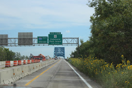
Today we are riding Hwy 18 (US 18; S17) east toward Goodfield, Illinois to camp for the night. Above the highway sign for South 27 is a blue sign – “Avenue of the Saints”, it must be because for the past 10+ miles it has be on the straight and narrow!

Fields, no acres, acres and acres of corn flank both sides of the four-lane along with windmill fields!  Twenty – thirty windmills turning out energy.

It is 10:00 a.m. with overcast skies and a cool 73 degrees.

Passing cornfields near Plainfield, some of the corn stalks were laying flat as if a strong wind had blown through a swath of the field leaving the rest of the corn stalks standing. This went on for several miles.

Waterloo, Iowa –home of the Sullivan Brothers. This article in the Navy Times in 2019, explains how this changed Navy regulations.

Spaghetti junctions under construction, high rise buildings, more than one (or none) stoplights, billboards, Dollar Tree and four bars for cell service – we are back in civilization!
Brian look it's Cargill

Civilization


We stopped in Iowa City for gas and lunch at “the Vine”. My portion of a nacho appetizer was huge.

Back lot parking


Gorgeous Sky


Coming into the restaurant, we had to park in the back lot with no out! So Doug had to back up in the parking lot, he did a great job. The sky is gorgeous. 

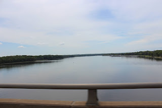
I drove the rest way into Timberline Campground in Goodfield, Illinois. Through that drive I traversed 5 or 6 construction zones of closing a two lane down to one lane at 45-55 mph. Doug caught this picture of the Mississippi.


Approaching the Mississippi River

Looking more like the Mississippi


Wonder who parked that
crooked camper!


Timberline campground is a huge campground. It is a tired-looking Jellystone.

This was a 9-hour drive, leaving at 8:10 a.m. and arriving 5:00 p.m. all in Central Time.


After supper, I tried baking a cake in the gas oven in the camper! I'll let the pictures tell the tale.


Wednesday August 25, 2021

 Day #31

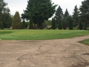
Doug was up early and on the golf course as evidence by these sunrise pictures.

Doug's pictures of the morning sunrise


Golf Course

More golf course


I spent the morning cooking spaghetti and posting blogs to get caught up from not having internet. The writing was there, it was the resizing and uploading the pictures that took so much time on limited internet.

Doug and I enjoyed a swim in the Olympic size, cold water pool. A five-year boy and his grandfather came to swim, but the boy spent more time checking the six pool drains for "toads" to catch than he was interested in swimming.

We had several air TV stations, so we could watch the national news,  Public TV, Wheel of Fortune, Family Feud, Jeopardy, Tales of Wells Fargo, Rawhide and Laramie. This was a big change from further north.

Cowboy caviar appetizer, spaghetti, salad and garlic toast for supper.  Leisurely reading and PBS history channel for the evening.

Tuesday, August 24, 2021

Day #30

I had forgotten to take pictures of the campground at Blueberry Hills, so I snapped these on our way out of the campground.  The property included the Blueberry Bowl (bowling, lounge, and dining), Blueberry Hills Golf Course (a nine hole golf course) and Blueberry Hills Campground.

Blueberry Bowl

Welcome sign


Leaving Blueberry Hills Golf Course and campground, we are heading toward Albert Lea to Hickory Hills campground in Twin Lakes.

We stopped in Crosby at their city park for a walk break and found the best playground I have seen. It was called the Tot Lot for kids two – five. On the lake was a dragon.


Tot Lot


An example of the many old farming building we have passed in our travels. This one was built beside a railroad track, probably for storage before shipping on railcars

Skirting past St. Cloud, Minnesota we had lunch in the suburbs at a Perkins Restaurant. Doug had loaded potato soup with half BLT. I had the most tender, flavorless porkchops. They were supposed to be grilled with garlic seasoning, but I couldn’t taste garlic!

As you can tell the Mississippi has widened a bit since leaving Lake Itasca. 


The windmill fields have started to reappear these were right on the highway. 


We arrived at Hickory Hills Campground in Albert Lea about 6:00 p.m. and called Larry. The Lady that Doug made reservations had told him that she would not be there and to call Larry, he would show us our site. Well Larry didn’t have us on his list, so he just put us in spot #8. Larry told us to drive around the circle to back into the spot and he would meet us there. He had Doug pull forward, backup, pull forward and back several times to get the camper backed into a site that could have been a pull through!

Because of fire restrictions, we have had one campfire in Michigamme. The fire restrictions continue here.

We enjoyed a quiet evening, what was left of it. 

Monday August 23, 2021

Day #29

First day of school for Ella, Kate and Abby! Learning and growing. It is such a joy to what them as they experience God’s world in new and different ways. Each of them may have the same experience, yet each will come away with a different perspective and learning experience.

As we headed out to the truck, the wind was brisk at 18 mph and 61 degrees with overcast skies. The weather app said it felt like 57 degrees.

Driving out of Warroad, we headed to Thief River Falls along miles and miles of fields on both sides of the road.

Doug and I were discussing how disappointed I was in the Waters of the Dancing Sky Scenic Byway. Miles of straight roads, I mean miles with fields of corn for silage, what we think is winter wheat and bales/rolls of hay and farms with houses and silos. Nothing else. I expected places like hiking trails or road side stops about historical markers. Nothing. Just wide-open fields. Within 45 minutes we were stopping along the site of the road for Doug to recalculated our drive to Grylga. Once in Grylga we calculated to Red Lake, a town on the Red Lake Indian reservation toward the head waters of the Mississippi River.

Around Red Lake and into the city of Red Lake, surprised at the lack of tourism in the city. Passing through a town with a school, government buildings and one Market. The market housed groceries, deli with hot bar (think Ingles variety of hot lunches), laundry and one table of souvenirs made in China. 

As we entered the Itasca State Park, where the head waters of the Mississippi River was located, I remember that there was a webcam at the headwaters. I had discovered it while researching our trip. I didn't know if anyone was available to view it, but I sent out a quick text to the kids for those who might be.

Itasca State Park is located near Grand Rapids, includes 32,000 acres, 100 lakes and was established in 1891. As we were driving in the Mary Gibbs Visitor Center, we took a short hike down to the lake, hoping to see the one of the lakes. Here the belief is less is more - less work is more trees, bushes that obscure the view. This was seen all along our travels. 

A pleasant walk to and from the headwaters and I encouraged Doug to wade. I think a couple people were able to view us on the webcam. Doug & I pulled it up and were able to view ourselves on the cam. 


Wading at the Mississippi Headwaters.
    
The pool below where Doug is standing,
flowing out of Lake Itasca


Mississippi river below the headwaters


The water was clear and cool, flowing out of Lake Itasca. The stream was about 4-6 feet wide and 14-18 inches deep. A family was walking the stream and could have walked it about 1/4 - 1/2 mile. The picture above was taken off a bridge further down stream on the hike back to the visitor center.

The area had three historical markers: one telling of the geology history of the area; second telling the history of the first colony of the Northwest Territory and the last how far it flows to the Gulf of Mexico.

Heading back to the campground on Sunday evening, we discovered that restaurants were few, far between and closed! French toast and sausage at the camper was followed with a quiet evening.
Post Review

Monday, August 30, 2021

 Day 36      Epilogue As the rains began to pound the earth, we decided it was time to tackle the last leg of our trip - arriving home. This...